A 15-mile walk, that is.
He often likes to get a bus or metro off someplace and then run home. This provides for different scenery.
He often likes to get a bus or metro off someplace and then run home. This provides for different scenery.
In this case, however, he got a bus to the Rising Sun Country Park in Wallsend (at the top of the red line) and then walked to The Angel of the North outside of Gateshead. He took a few photos along the way.
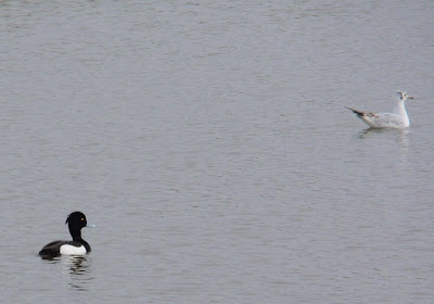
These are tufted ducks at the Rising Sun.
There were also moorhens. It's tricky taking photos of birds: they don't stay still for long and tend to be far away.
The new underpass to allow pedestrians and cycles to cross under the Coast Road was striking on a somewhat grey day.
Holy Cross at Wallsend is a popular drinking spot for the 'yoof', I'm guessing from the litter. Bill reckons these stones are what St. Leonard's Hospital at Northumberland Park would likely have resembled.
The bridge over the gorge at Rosehill has been newly painted. I believe it's called Willington viaduct, built 1837-9, and it's a 'listed' feature, which means protected from demolition because of its historic value.
This was originally Haggies Rope, then British Rope then Bridon Fibres. Apparently it has always been considered to be haunted. Maybe that's why this interesting shaped building hasn't been developed into flats or something.
These are swans on the river at Dunston.
I remember the time I spent working at the Environment Agency. From their offices on the north side of the river there was a great view of Dunston Staithes, opposite, the history of which I find fascinating. Otherwise, I remember running on the Dunston side with Bill one evening when he told me about an American murderer having been apprehended at the Royal Hotel there. It was creepy, the place we were at when he told me the story; I've never gone back there. Personally, I recommend viewing the Staithes from the Newcastle side.
Bill's main destination was Causey Arch Bridge, something he'd never visited before.

Causey Arch is the oldest surviving railway bridge, built in the early 1700s to allow horse drawn wagons to transport coal from the Tanfield mines to the River Tyne.

The two rails were termed 'main way' and 'bye way'. Along the flat part of the main way (towards the river), horses pulled the coal forward.
 For the steep part down to the river, the horses controlled the downward descent of the carts. They returned along the 'bye way' with empty carts.
  I just realised this is where you get the staying about 'highways and byeways'...
 The signage there says that ballast (scrap coal) was put between the sleepers to protect the sleepers from the horses' hooves.

The wooden rails of the byeways lasted about three years, but the main way only lasted about one year. The bridge was only in use for about 14 years, as the Tanfield mines caught fire in 1739.
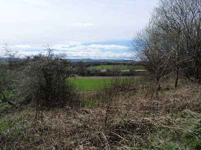
If you enlarge the map/photo at the top, you can see that the eastern portion is quite built up and actually a lot of it is industrial.

This is not a very pretty part of the North East. However, there are green areas tucked in alongside the concrete and brick and some of them are surprisingly attractive. It is one of the things I like about Britain, that although it is densely populated to a degree that makes me a bit crazy at times, there are green spaces that have been preserved.

Life during the industrial age in this part of the world must have been horrific, and yet people flocked to live in the cities from the the countryside. This does suggest that country life may have been pretty but it must also have been quite hard. I suspect we're all very soft compared with our forebears, don't you?
Except for Bill, of course, who still walks 15 miles for fun.
To be continued...


4 comments:
This was actually 2 walks. One was 2 weeks ago, 13 miles from Palmersville Metro through the Rising Sun Country Park and Wallsend Dene and back home along the Riverside. Last week was 15 miles from Gateshead Metro up the Tanfield railway to Causey Arch and then down the Bowes Railway path to the Angel. And yes the Bowes Railway and Hetton Lyons were all owned by the "Bowes Lyon" estate of Queen Mother Fame
Walk 15 miles for "fun"? That boys idea of "fun" is much different than most of us.
My city has these little areas of green too...because we have city planning now. It IS horrific to think about conditions in the early days before planning had caught on. Are there roadways atop these arched bridges that are so old?
The green painted metal bridge has been in constant use since it was built. The Suburban railway "The Metro" runs over it from where we live into Newcastle every 10 minutes.
The old stone railway bridge goes nowhere since the colliery closed in 1750. That's why it has lasted so long. The much heavier steam hauled trains would have wrecked it. It is just a footpath now so you can walk over it
Post a Comment